Clarity Through Spatial Intelligence
At orbivis, we offer expert advisory in geospatial intelligence and strategic partnerships, helping industry and government unlock smarter decision-making. Whether through satellite imagery, GIS mapping, or tailored partnerships, we connect clients with the right technology, expertise, and insight.
Our experience spans GEOINT, satellite remote sensing, GNSS asset mapping, and GIS strategy — supporting infrastructure, utilities, resources, and government. We focus on representation and partnerships that link global innovation with local needs, delivering actionable solutions that empower clients to see more, know more, and act faster.

Geospatial intelligence Consultation, Partnerships & Representation
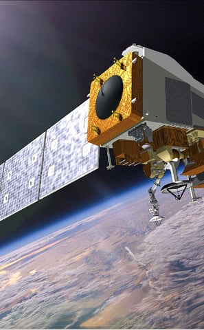
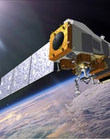
NEWS: Orbivis Appointed Referral Agency for Synspective, a Japanese SAR Satellite Operator, in Oceania
Orbivis is proud to represent Synspective’s advanced radar satellite capabilities across the Oceania region, enabling millimetre-accurate monitoring for infrastructure, mining, and environmental applications.
🔗Explore Our Services →
Learn how we help clients across Oceania monitor infrastructure stability, flood risk, terrain shifts, and environmental change — using Synspective’s radar satellite technology.
Business Intelligence & Advisory
Helping organizations leverage geospatial data for smarter decision-making


Geospatial Market Strategy & Sales – Advising companies on entering and scaling in new geospatial markets, with expertise in B2B solutions.
Go-to-Market Strategy for Space & GIS Solutions – Helping geospatial and satellite companies develop sales, marketing, and partnership strategies.
Project & Proposal Management – Supporting organizations in developing competitive proposals, including multi-million-dollar government tenders.
Geospatial Business Innovation – Advising startups and enterprises on leveraging GIS, remote sensing, and spatial analytics for business transformation.
Industries:
Domestic and international service providers, geospatial software companies, international defence contractors
Our Expertise:


Space-based Solutions


Strategic Geospatial Advisory – Providing expert guidance on satellite remote sensing, GEOINT, emergency response, and asset monitoring to help clients navigate the complex geospatial landscape.
Tailored Satellite Imagery Solutions – Advising on fit-for-purpose satellite imagery, including sourcing, cost estimation, acquisition strategies, and integration with analytics.
Project Oversight & Risk Management – Ensuring projects stay on track by providing timeline management, quality assurance, and risk mitigation strategies for geospatial initiatives.
Industry-Backed Network of Experts – Leveraging a trusted ecosystem of technical specialists to deliver tailored geospatial solutions, ensuring clients access the most suitable expertise for their specific needs.
Collaborative Partnership Model – Connecting clients with specialist service providers for technical execution while maintaining strategic oversight and project management to ensure smooth delivery and successful outcomes.
AI & Geospatial Analytics Integration – Advising on the use of AI/ML-driven analytics for object detection, pattern recognition, and automated mapping to enhance decision-making.
Industries:
Goverment, GEOINT, Environment, Mineral Resources, Maritime, Insurance
Our Expertise:

Helping organizations leverage space-based insight for decision-making
Geospatial Intelligence Solutions
Transforming data into actionable insights for government and commercial sectors
Our Expertise:
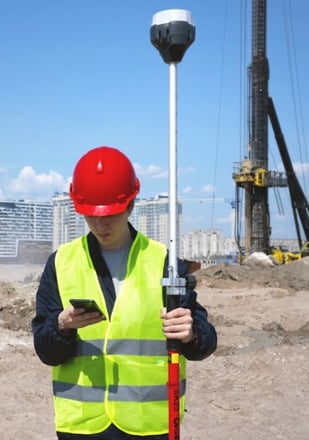
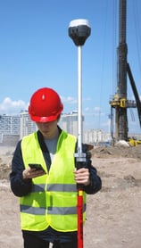
Advanced Spatial Data Strategies – Recommending cutting-edge acquisition methodologies (GNSS, Remote Sensing) to maximize quality, accuracy, and applicability.
Remote Sensing & Image Analysis – Utilizing satellite and aerial imagery to monitor environmental changes, urban development, and resource management.
Geospatial Data Integration – Combining multiple data sources (satellite, aerial, IoT) into comprehensive geospatial databases for enhanced analysis.
Asset Mapping Data Quality Assurance – Implementing protocols to ensure accuracy, reliability, and compliance with geospatial standards.
GIS Functional Specifications & UI Design – Assisting in the development of GIS applications with a focus on usability, operational efficiency, and system interfacing.
Augmented Reality for Enhanced Analysis – Guiding AR integration to improve spatial data visualization for decision-makers.
Optimized Utility & Asset Mapping –
Provide strategic direction on GPS-based asset and utility mapping, ensuring efficient resource management, infrastructure planning, and long-term operational sustainability.


Industries:
Local Goverment, Utilities, Mineral Resources Exploration

Geospatial Partnerships & Representation
Bridging Global Innovation with Local Insight


Market Representation & Agency – Act as a representative for foreign geospatial software companies, introducing advanced satellite imagery and mapping solutions to the Australian market.
Strategic Partnership Building – Establish and nurture key industry relationships, facilitating successful collaborations and the effective execution of geospatial projects.
Channel Partner & Business Development – Identifying opportunities for collaboration in the space and geospatial sectors, including defense, commercial, and research.
Go-to-Market Strategy for Space & GIS Solutions – Helping geospatial and satellite companies develop sales, marketing, and partnership strategies.
Industries:
Domestic and international service providers, geospatial software companies, international defence contractors
Our Expertise:


Not sure where to start? View our service offerings tailored to your industry.
👉 Visit Our Services Page →
Contact:
Email: contact@orbivis.com.au
© 2025. All rights reserved.
ABN: 23 021 187 233
Address: Sydney, Australia
Contact Us
Reach out to orbivis for geospatial solutions and data-driven decision-making support today.