 Start a Conversation →
☰ Menu
All-weather insight.
Real-world impact.
Satellite intelligence for maritime security, land and infrastructure monitoring, and disaster response. Orbivis connects international space and geospatial capabilities with the needs of Australian defence, government and industry.
Discuss your use case → SAR / OPTICAL IMAGERY / GEOSPATIAL ANALYTICS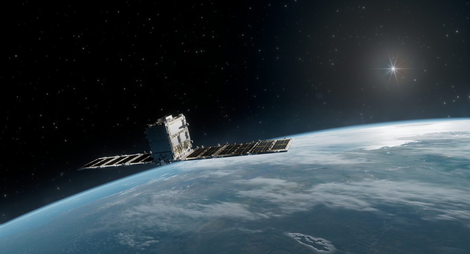
Connecting satellite observation with maritime awareness, infrastructure monitoring and disaster response.
SYNSPECTIVE STRIX / SYNTHETIC APERTURE RADAR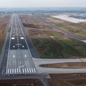
GEOINT & maritime
domain awareness.
Land & infrastructure
disturbance monitoring.

Flood mapping &
post-disaster assessment.
SYNSPECTIVE × ORBIVIS
Global SAR capability.
Your Australian connection.
Orbivis is Synspective’s official referral agency for Australia and Oceania. Learn how the relationship connects your imagery and monitoring requirements with Synspective’s satellite data and solutions.
Maritime &
Border GEOINT.
Persistent intelligence across oceans, ports and airfields.
Monitor vessels, ports and airfields across coastal and offshore areas with satellite-based GEOINT. Synthetic Aperture Radar (SAR) supports observation through cloud and darkness; analytics turn those observations into usable intelligence.
From ships operating without AIS to activity around transport hubs and trade routes, these capabilities support maritime security, border protection and operational awareness.
Discuss this solution →Maritime domain awareness, powered by space.
The oceans are vast and risks can remain hidden. Day and night space-based monitoring helps detect, match and identify activity.
Vessel monitoring
Track activity across exclusive economic zones, shipping routes and coastal waters.
Dark ship detection
Identify vessels with AIS switched off and investigate potential spoofing.
Port & airfield monitoring
Observe changes and activity patterns around transport hubs.
Illegal activity detection
Support investigations of unauthorised entry, illegal fishing and smuggling.
Defence · Border protection · Maritime safety · Port and airport operators · Energy and resources
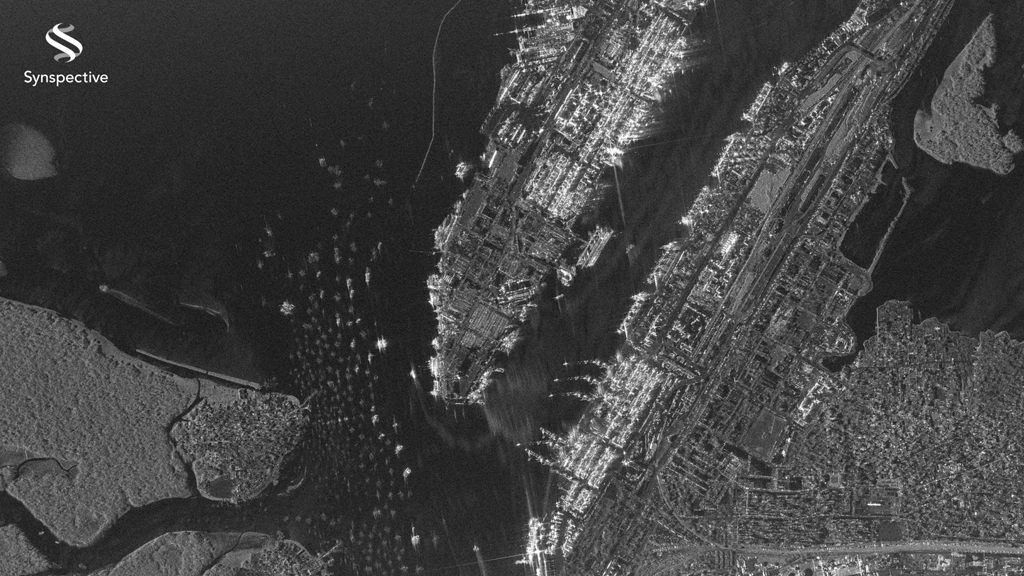
Persistent all-weather port monitoring with SAR.
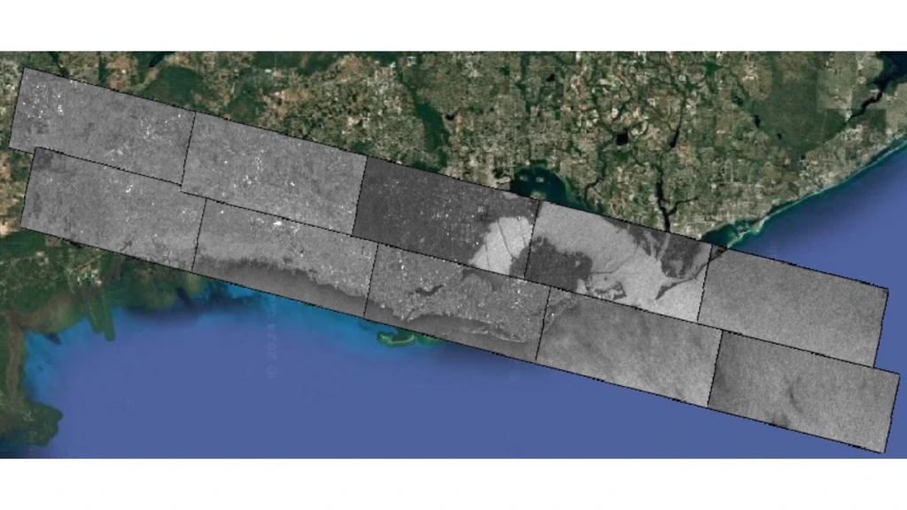
Long-strip SAR capture for wide-area monitoring.
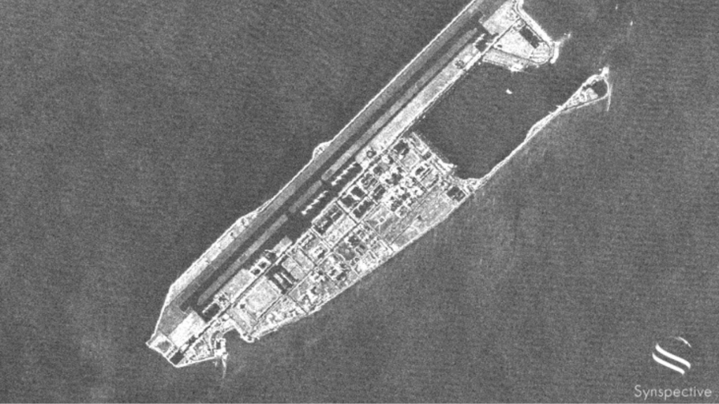
Persistent all-weather airfield monitoring with SAR.
Land & infrastructure
disturbance monitoring.
Detect land change, ground movement and emerging risk.
Monitor large and remote areas using high-resolution optical imagery, SAR and geospatial analytics. Compare observations over time to identify disturbance, development, environmental change and emerging infrastructure risks.
InSAR adds millimetre-scale ground movement analysis to support monitoring of assets, urban areas and terrain. Bring the results into GIS and reporting workflows to inform asset management and planning.
Discuss this solution →Hidden ground movement. Visible intelligence.
Mining, tailings dams, landslides, sinkholes and agricultural subsidence. Space-based InSAR detects millimetre-scale ground motion, with persistent monitoring, GIS-ready outputs and centralised reporting.
Land disturbance detection
Identify changes to terrain, vegetation and surface conditions over time.
Infrastructure monitoring
Follow construction, asset development and site progression.
Environmental monitoring
Observe deforestation, degradation and impacts on ecosystems.
Change detection & analytics
Use multi-temporal imagery to reveal anomalies and longer-term trends.
Transport · Airports · Mining · Urban infrastructure · Utilities, including pipelines, substations and water assets
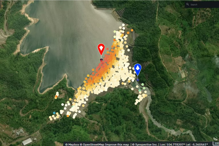
Land displacement measurements from space-based InSAR.
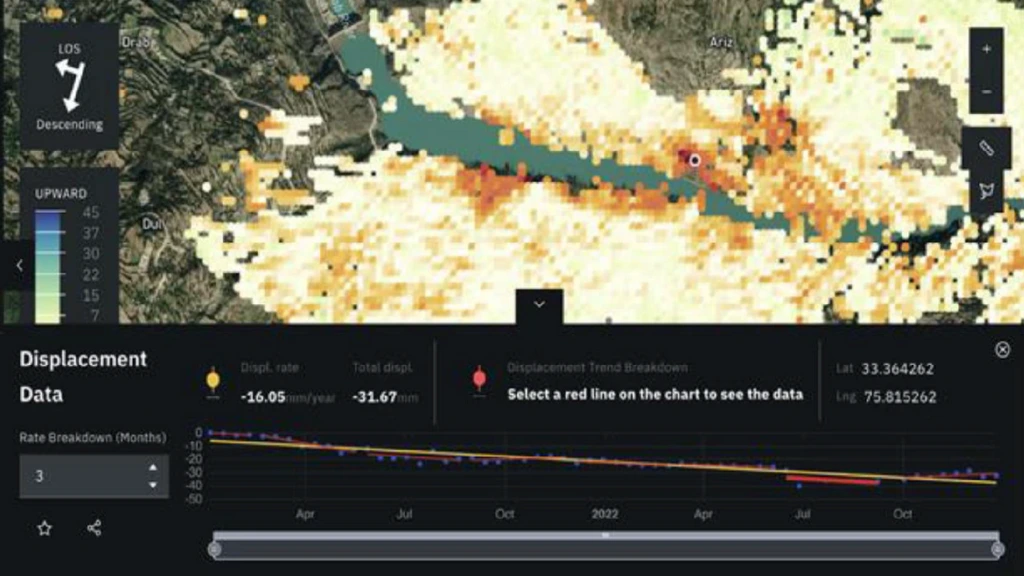
Land displacement monitoring analysis.
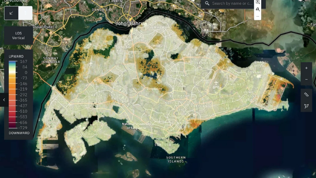
Long-term monitoring of subsidence across entire cities.
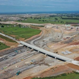
Motorway construction monitoring.
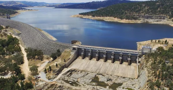
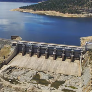
Ground deformation monitoring around dams.
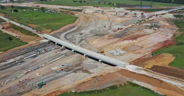
Monitoring bridges and highways.
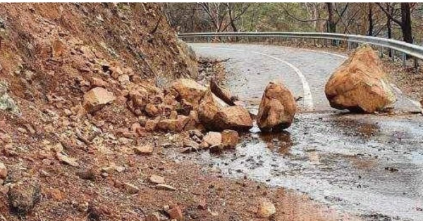
Slope stability and landslide monitoring.
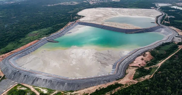
Deformation monitoring of tailings dams.
See land displacement
monitoring in practice.
Watch Synspective demonstrate land displacement monitoring and its practical applications.
Flood mapping &
post-disaster assessment.
Rapid flood intelligence for response, assessment and recovery.
Build a view of inundation across urban, rural and inaccessible areas using SAR, optical imagery and geospatial analysis. Identify flood extent and assess potential impacts on communities and infrastructure.
Track conditions as an event develops and support response priorities, damage assessment and recovery planning. Radar observations through cloud cover are particularly useful during severe weather.
Discuss this solution →Informed decisions. Faster response.
Floodwaters can rise and spread rapidly. SAR supports rapid tasking and GIS-ready flood extents, bringing field-ready maps and operational clarity to emergency response.
Flood extent mapping
Delineate inundation across urban, rural and remote areas.
Infrastructure impact assessment
Identify potential effects on roads, bridges and critical assets.
Event monitoring
Follow the progression of floodwaters during and after an event.
Recovery & planning support
Inform prioritisation, recovery activity and future resilience measures.
Local and state government · Emergency services · Engineering · Water, energy and telecommunications utilities · Insurance · Agriculture · Environmental and catchment authorities
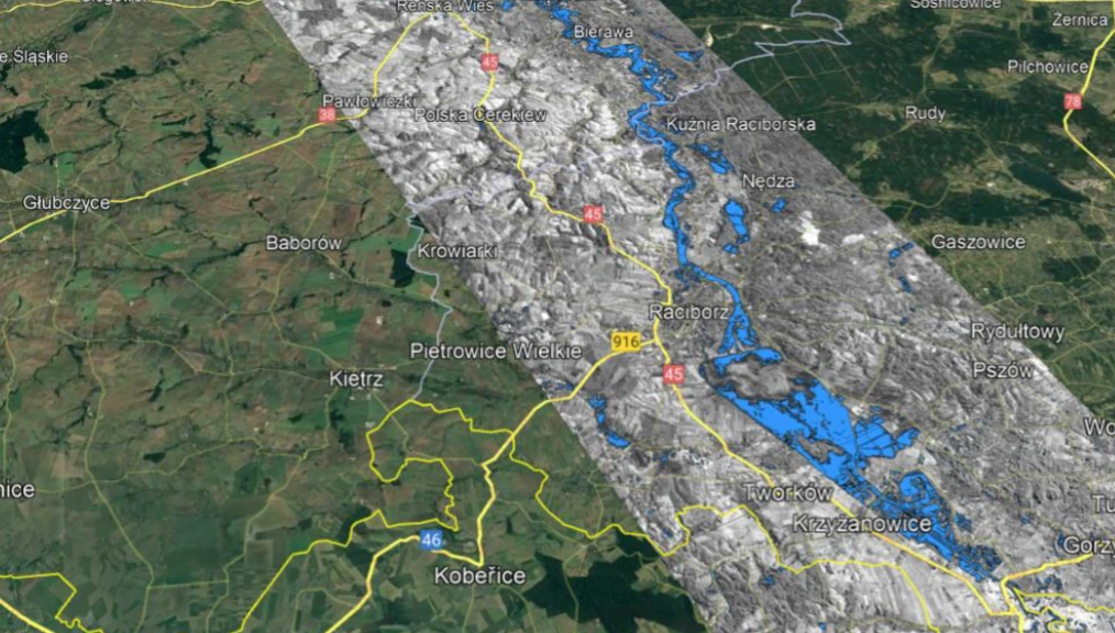
Image entire river sections in a single stripmap, in all weather.
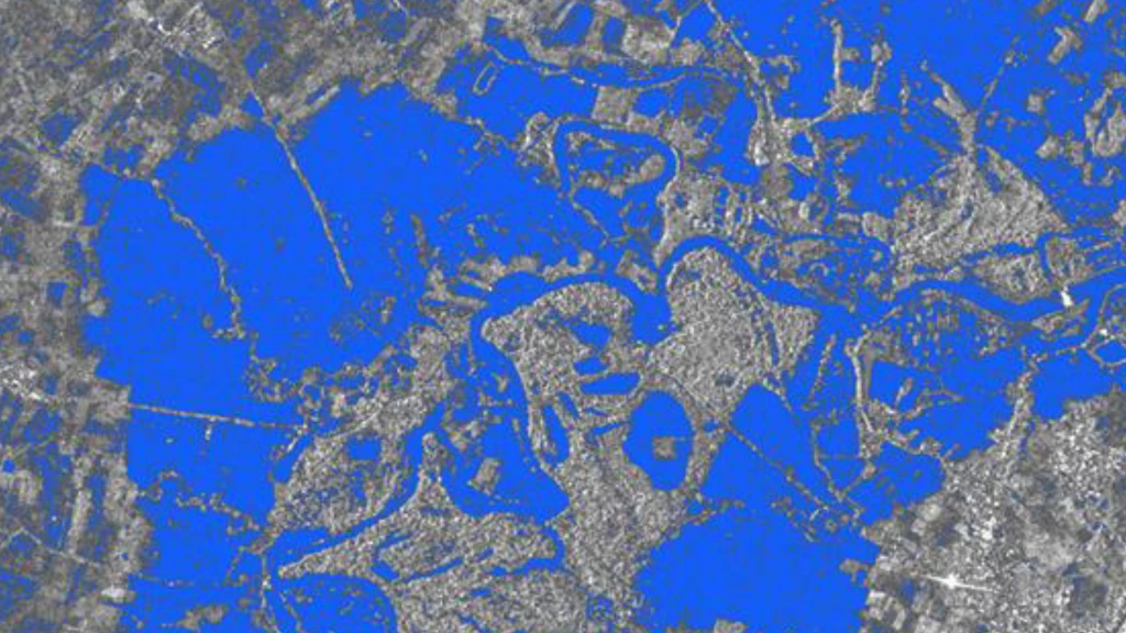
Delivery of flood extents in GIS format.
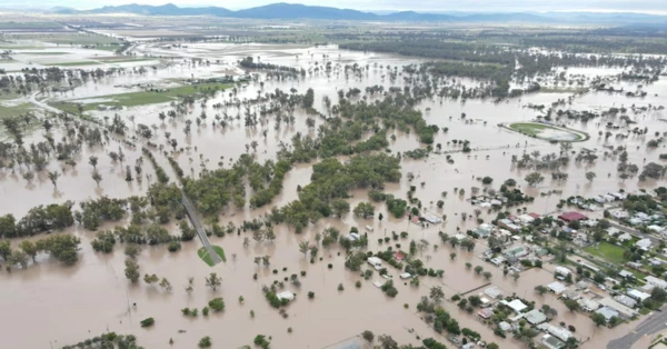
Flood monitoring and impact assessment.
Explore flood damage
assessment in practice.
Watch Synspective demonstrate flood damage assessment and its practical applications.
Tell us where
you need insight.
Share a location, the assets or activity you need to understand, and your operational priorities. Pinpoint your area of interest on the imagery request map, or discuss the use case with Orbivis.
Mark your location on the map and share your imagery requirements.