 Discuss your use case →
☰ Menu
LIVE SHOWCASE / ORBIVIS
Intelligence.
In action.
From orbital access to intelligence on the ground.
Explore live hazard feeds and satellite access in one place. Two interactive experiences reveal how space and geospatial intelligence can support a clearer view of what is happening—and what could be observed next.
NEAR REAL-TIME FEEDS / CALCULATED ORBITAL ACCESS
Choose an experience above to begin.
Conditions, context and exposure.
Use the layer controls to explore flood alerts, fire hotspots, observed rainfall, weather imagery and indicative SAR opportunities. Search for a location or select an alert to inspect the map.
Near real-time public feeds may be delayed, incomplete or subject to change. This showcase supports situational awareness; use official government warnings for emergency decisions. Official warning services ↓
Orbital geometry, access and revisit.
Zoom in and out to view live satellite orbits from Synspective’s constellation and turn on the heatmap to explore the revisit across Australia. Select an access opportunity to inspect pass details and request SAR tasking.
Satellite positions are calculated using publicly available Two-Line Element (TLE) data and standard SGP4 propagation for visualisation purposes only. This tool is not intended for operational, navigational, safety-critical, or commercial decision-making.
Understanding satellite access & revisit
The LEO Access Explorer demonstrates how orbital architecture shapes access, revisit frequency, and mission feasibility. This interactive environment compares Sun-Synchronous Orbits (SSO) and Mid-Inclination Orbits (MIO), illustrating how constellation design influences coverage across Australia and the Indo-Pacific.
Use the live satellite tracks to understand orbital geometry in motion, and activate the access heatmap to visualise aggregated next-24h access opportunities within defined off-nadir constraints.
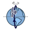
Sun-Synchronous Orbit (SSO)
- Near-polar inclination (~97–98°)
- Consistent local solar time for repeatable observation geometry
- Strong high-latitude revisit and global coverage patterns
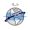
Mid-Inclination Orbit (MIO)
- Inclination typically ~40–60°
- Optimised for mid-latitude density
- Higher revisit frequency in targeted regions
What this explorer shows: live satellite positions (TLE propagation), next-24h ground tracks, an access heatmap showing aggregated opportunity within off-nadir limits, and mission feasibility cues derived from orbital geometry.
Official emergency warning services
The Orbivis Hazard Intelligence Dashboard provides situational awareness using selected public hazard datasets. For official warnings, emergency instructions and public safety advice, always refer to the relevant government emergency authority below.
Important: Orbivis is not an emergency warning service and should not be relied upon as the sole source of emergency information. During emergencies, always follow advice issued by the relevant emergency authority and call Triple Zero (000) in life-threatening situations.
FROM EXPLORATION TO APPLICATION
What could this mean
for your organisation?
Discuss satellite flood mapping, infrastructure monitoring, imagery requirements or access and revisit planning with Orbivis.
Discuss your use case →