 Discuss SAR requirements →
☰ Menu
SYNSPECTIVE × ORBIVIS / AUSTRALIA & OCEANIA
Synspective SAR.
Australian insight.
Access Synspective’s SAR satellite data and monitoring solutions through Orbivis, its official referral agency for Australia and Oceania.
A local starting point for imagery, land displacement monitoring, flood assessment and maritime intelligence—with your operational requirements at the centre.
Discuss your SAR requirements → How the relationship works ↓SAR IMAGERY / MONITORING SOLUTIONS / LOCAL SUPPORT
GLOBAL CAPABILITY. LOCAL CONNECTION.
+
STRIX / SYNTHETIC APERTURE RADAR
Observation beyond daylight
and cloud cover.
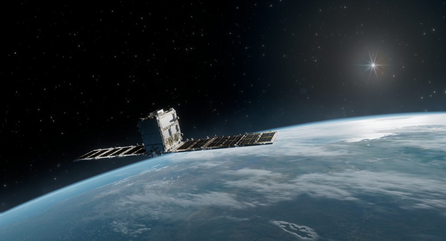
Synspective StriX satellite illustration. Image: Synspective.
THE RELATIONSHIP
Space capability.
A local point of contact.
01 / SYNSPECTIVE
The satellite data and solutions.
Synspective develops and operates the StriX SAR satellite constellation and provides satellite data and derived monitoring solutions. Its capabilities support observation of activity, movement and change across land and maritime environments.
Explore Synspective’s SAR data ↗02 / ORBIVIS
Your Australian connection.
Orbivis is Synspective’s official referral agency for Australia and Oceania. We help local organisations frame their requirements, explore relevant capabilities and connect with Synspective for technical and commercial discussions.
Bring us the location, the question you need to answer and the timing that matters. We help shape the next conversation around the application, not just the imagery.
A clear division of roles: Synspective provides its satellite data and monitoring products; Orbivis provides the local referral and advisory connection.
DAY + NIGHT
Radar works without sunlight.
SAR uses active radar sensing, enabling observations during darkness and through cloud cover.
DATA + ANALYSIS
Start with the output you need.
Explore satellite imagery, repeat observations or derived monitoring products to suit your application.
LOCAL + GLOBAL
Connect requirements to capability.
Discuss your area of interest with Orbivis and identify the appropriate Synspective technical conversation.
SAR IN PRACTICE
Three starting points.
One conversation about your needs.
The right application depends on your location, timing and the decision you need to support. These established use cases provide a starting point.
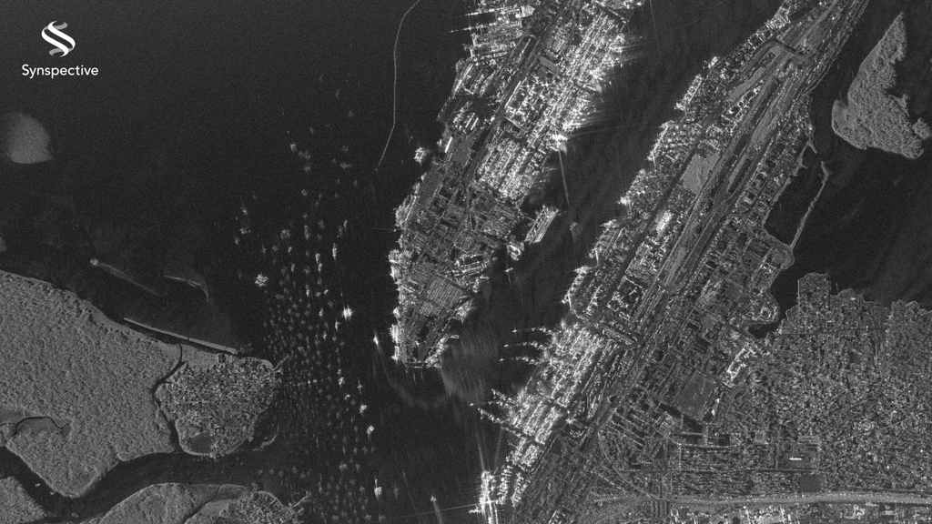
Illustrative SAR imagery of a port. Image: Synspective.
01 / APPLICATION
Maritime & border intelligence
Explore SAR imagery for vessel detection, port and airport activity, and repeat observation of areas of interest. Combine radar observations with other intelligence sources to build context.
For defence, border protection, maritime authorities and port operators.
Explore this application →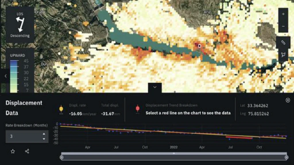
Land displacement visualisation. Image: Synspective.
02 / APPLICATION
Land displacement monitoring
Discuss InSAR-based monitoring of gradual ground movement around transport corridors, dams, tailings facilities and other infrastructure. Assess whether the site and observation history suit the monitoring question.
For mining, infrastructure, utilities, transport and engineering teams.
Explore this application →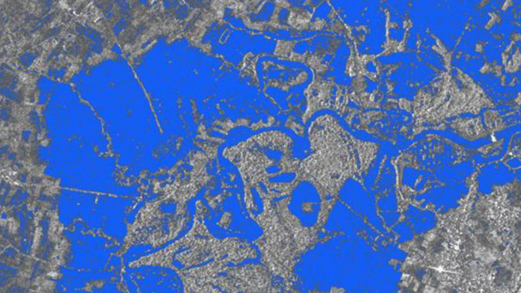
Flood extent delivered in GIS format. Image: Synspective.
03 / APPLICATION
Flood damage assessment
Explore radar-derived flood extent and post-event assessment when cloud cover limits optical imagery. Discuss the area, acquisition timing and output needed for recovery planning or impact analysis.
For government, emergency management, insurers, utilities and catchment authorities.
Explore this application →FROM REQUIREMENT TO NEXT STEP
Start with your question.
Build the right brief.
01
Describe the decision.
Tell us what you need to observe, where it is and why it matters. Share an area of interest or coordinates if available.
02
Explore the fit.
Discuss imagery or monitoring options, the timing you need and the outputs that will be useful to your team.
03
Connect with Synspective.
Orbivis helps coordinate the referral and the appropriate technical or commercial discussion.
04
Agree the next step.
Clarify feasibility, scope, delivery expectations and commercial terms before progressing a tasking or monitoring requirement.
Acquisition availability, revisit, delivery times, suitability and pricing depend on the specific requirement and provider assessment.
BEFORE YOU ENQUIRE
A few useful answers.
Can I request sample imagery?
Yes. Tell us your location and application so we can discuss relevant sample data or a demonstration. Availability and any conditions depend on the product and provider.
Can I request new acquisitions?
Discuss your area of interest, preferred observation dates and intended use. Tasking feasibility and delivery requirements are assessed with the provider; a demonstration does not reserve an acquisition.
What should I include in an enquiry?
Your organisation, application, location or area of interest, timing, and the output you need. If you already have a brief or GIS area, mention it in your message.
Where can I explore the capability first?
The Solutions page explains the applications in more detail. Live Showcase offers interactive hazard feeds and indicative satellite access visualisations to support an initial discussion.
START A SAR DISCUSSION
Tell us what you need
to see, measure or monitor.
Send your requirements to Orbivis. Include your organisation, area of interest, application and preferred timing so we can start a useful conversation about Synspective’s capabilities.
Prefer email? info@orbivis.com.au