All-weather satellite intelligence for maritime security, infrastructure monitoring, and disaster response.
By combining Synthetic Aperture Radar (SAR) with advanced analytics, Orbivis enables continuous monitoring of vessels, critical infrastructure, and environmental events — supporting defence, government, and industry decision-making across Australia.
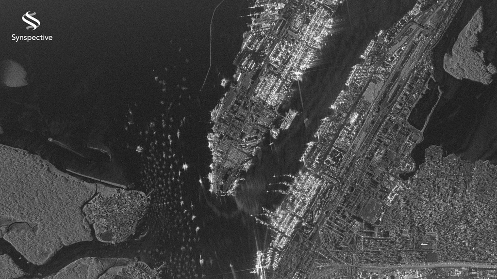
Maritime & Border GEOINT
Persistent maritime and border intelligence across oceans, ports and airfields
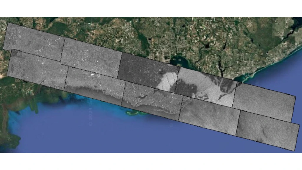
Satellite-based GEOINT enables continuous monitoring of vessels, ports, and airfields across vast coastal and offshore regions — delivering actionable intelligence in all weather, day or night.
By combining Synthetic Aperture Radar (SAR) with advanced analytics, Orbivis provides reliable situational awareness for defence, border protection, and maritime security operations. From detecting vessels operating without AIS to monitoring critical infrastructure and trade routes, our capabilities support timely, data-driven decision-making at scale.
Key Applications
Vessel Monitoring — Track vessel movements across EEZs, shipping lanes, and coastal waters
Dark Ship Detection — Identify vessels operating with AIS switched off or engaged in spoofing
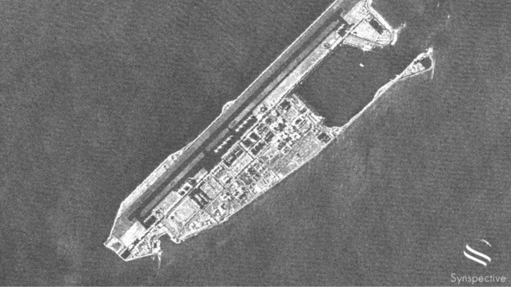
Port & Airfield Monitoring— Observe activity patterns across key transport hubs
Illegal Activity Detection — Support detection of smuggling, illegal fishing, and unauthorised entry
Persistent maritime and border intelligence across oceans, ports and airfields.
THE OCEANS ARE VAST
RISKS OFTEN STAY HIDDEN
DAY / NIGHT SPACE-BASED MONITORING
DETECT. MATCH. IDENTIFY.
MARITIME DOMAIN AWARENESS POWERED BY SPACE
Satellite-based GEOINT enables continuous monitoring of vessels, ports, and airfields across vast coastal and offshore regions — delivering actionable intelligence in all weather, day or night.
By combining Synthetic Aperture Radar (SAR) with advanced analytics, Orbivis provides reliable situational awareness for defence, border protection, and maritime security operations. From detecting vessels operating without AIS to monitoring critical infrastructure and trade routes, our capabilities support timely, data-driven decision-making at scale.
Key Applications
Vessel Monitoring — Track vessel movements across EEZs, shipping lanes, and coastal waters
Dark Ship Detection — Identify vessels operating with AIS switched off or engaged in spoofing
Port & Airfield Monitoring— Observe activity patterns across key transport hubs
Illegal Activity Detection — Support detection of smuggling, illegal fishing, and unauthorised entry
Industries:
Defence, border protection, maritime safety authorities, port & airport operators, energy and resource companies.
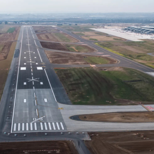
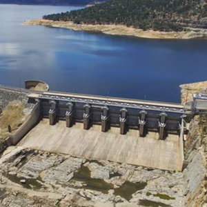
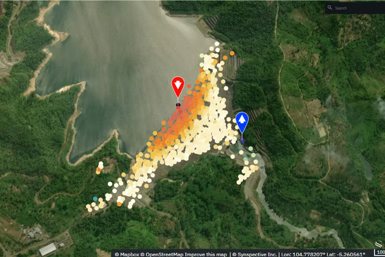
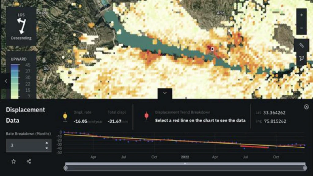
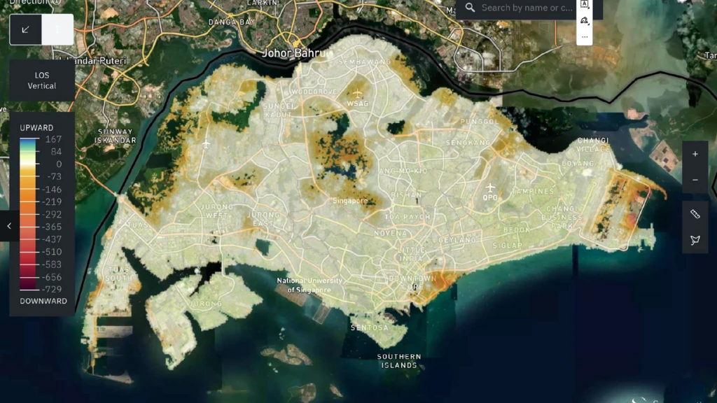
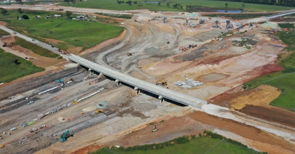
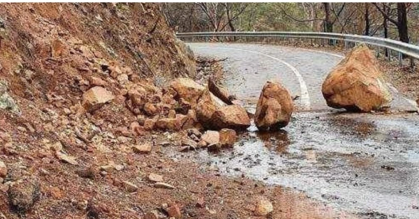
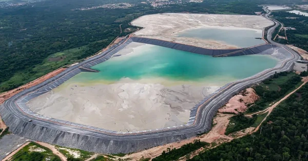
Detecting land change, disturbance and emerging risk at scale
Satellite-based Earth observation enables continuous monitoring of land surfaces across large and remote areas — supporting early detection of change, degradation, and emerging risks in near real time.
By combining high-resolution optical imagery, Synthetic Aperture Radar (SAR), and advanced analytics, Orbivis provides reliable insights into land disturbance, infrastructure activity, and environmental impact. From monitoring mining operations and deforestation to tracking urban expansion and infrastructure development, our capabilities support informed decision-making across government and industry.
Key Applications
Land Disturbance Detection — Identify changes in surface conditions, vegetation, and terrain over time
Infrastructure Monitoring — Track construction activity, asset development, and site progression
Environmental Monitoring — Detect deforestation, land degradation, and ecosystem impact
Change Detection & Analytics — Compare multi-temporal imagery to highlight anomalies and trends
Industries:
Transportation, Airports, Mining, Urban transportation, utilities (pipelines, substations, water tanks)
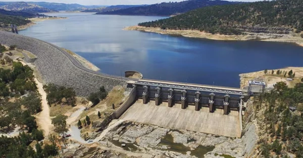
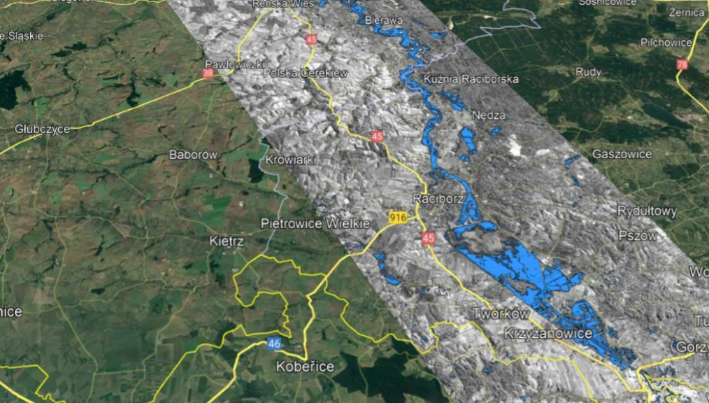
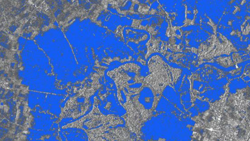
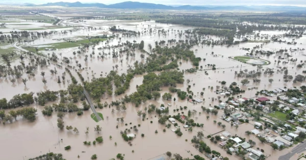
Rapid flood intelligence for event response and impact assessment
atellite-based flood mapping enables fast, reliable visibility of inundation extent across large and often inaccessible areas — supporting emergency response, damage assessment, and recovery planning.
Leveraging Synthetic Aperture Radar (SAR), optical imagery and advanced geospatial analytics, Orbivis enables rapid identification of flooded areas, assessment of impacts on infrastructure and communities, and continuous monitoring of evolving conditions. These capabilities support timely, data-driven decision-making when speed and accuracy matter most.
Key Applications
Flood Extent Mapping — Delineate inundated areas quickly across urban, rural, and remote
Infrastructure Impact Assessment— Identify impacts on roads, bridges, assets, and critical
Event Monitoring — Track the progression of floodwaters during and after an event
Recovery & Planning Support — Inform response prioritisation, recovery planning, and resilience measures
FLOODS REGULARLY DEVASTATE AUSTRALIAN COMMUNITIES
FLOODWATERS RISE AND SPREAD RAPIDLY
SPACE-BASED SAR DELIVERS FLOOD MAPS WITHIN HOURS — NOT DAYS
RAPID SELF-TASKING. NO HUMAN IN THE LOOP. GIS-READY FLOOD EXTENTS.
INFORMED DECISIONS. FASTER RESPONSE.
SEE THROUGH CLOUDS • FIELD-READY MAPS • OPERATIONAL CLARITY
Flood Mapping & Post-Disaster Assessment.
Rapid flood intelligence for event response and impact assessment
FLOODS REGULARLY DEVASTATE AUSTRALIAN COMMUNITIES
FLOODWATERS RISE AND SPREAD RAPIDLY
SPACE-BASED SAR DELIVERS FLOOD MAPS WITHIN HOURS — NOT DAYS
RAPID SELF-TASKING. NO HUMAN IN THE LOOP. GIS-READY FLOOD EXTENTS.
INFORMED DECISIONS. FASTER RESPONSE.
SEE THROUGH CLOUDS • FIELD-READY MAPS • OPERATIONAL CLARITY
Satellite-based flood mapping enables fast, reliable visibility of inundation extent across large and often inaccessible areas — supporting emergency response, damage assessment, and recovery planning.
Leveraging Synthetic Aperture Radar (SAR), optical imagery and advanced geospatial analytics, Orbivis enables rapid identification of flooded areas, assessment of impacts on infrastructure and communities, and continuous monitoring of evolving conditions. These capabilities support timely, data-driven decision-making when speed and accuracy matter most.
Key Applications
Flood Extent Mapping — Delineate inundated areas quickly across urban, rural, and remote
Infrastructure Impact Assessment— Identify impacts on roads, bridges, assets, and critical
Event Monitoring — Track the progression of floodwaters during and after an event
Recovery & Planning Support — Inform response prioritisation, recovery planning, and resilience measures
Industries:
Local and state government, emergency services, civil and infrastructure engineer.ing, utilities (water, energy, telecommunications), insurance, agriculture, and environmental and catchment management authorities
Local and state government, emergency services, civil and infrastructure engineer.ing, utilities (water, energy, telecommunications), insurance, agriculture, and environmental and catchment management authorities